Zambia (
IPA:
[ˈzæmbɪə]), officially the
Republic of Zambia, is a
landlocked country in
Southern Africa. It borders the
Democratic Republic of the Congo to the north,
Tanzania to the north-east,
Malawi to the east,
Mozambique,
Zimbabwe,
Botswana, and
Namibia to the south, and
Angola to the west. Formerly
Northern Rhodesia, the country's name reflects the
Zambezi river.
History In the 1st century, technologically-advanced migrating tribes began to displace or absorb the indigenous
Khoisan hunter-gatherer occupants. In the
12th century, major waves of
Bantu-speaking immigrants arrived during the
Bantu expansion. Among them, the
Tonga people (also called Batonga) were first to settle in Zambia and are believed to have come from the far east near the "big sea." The
Nkoya people had also come early in the expansion, with some suggesting that they were the first of the expansion into today's Zambia, having come from the
Luba-Lunda kingdoms in the north.
In the late
17th and early
19th centuries, other groups followed with the greatest influx coming between . These later migrants also came primarily from the Luba-Lunda tribes of southern
Democratic Republic of Congo and northern
Angola but in the 19th century the
Ngoni peoples from the south joined them. By the later part of the 19th century, most of the various peoples of Zambia were largely established in the areas they currently occupy. In the early 18th century, the
(Nsokolo People) under the leadership of Joe Nsokolo Chupa, also known as Elvin, settled in Mbala district in Northern province .
European colonial era A two-stage election held in October and December
1962 resulted in an African majority in the legislative council and an uneasy coalition between the two African nationalist parties. The council passed resolutions calling for Northern Rhodesia's secession from the federation and demanding full internal self-government under a new constitution and a new
National Assembly based on a broader, more democratic franchise. Led by
Kenneth Kaunda, on
31 December 1963, the federation was dissolved, and Northern Rhodesia became the Republic of Zambia on
24 October 1964. At that time, Kaunda became the country's first president.
At independence, despite its considerable mineral wealth, Zambia faced major challenges. Domestically, there were few trained and educated Zambians capable of running the government, and the economy was largely dependent on foreign expertise. Abroad, three of its neighbours – Southern Rhodesia and the Portuguese colonies of Mozambique and Angola – remained under white-dominated rule. Southern Rhodesia's white-ruled government unilaterally declared independence in November, 1965. In addition, Zambia shared a border with South African-controlled South-West Africa (now
Namibia).
Independence Zambia's sympathies lay with forces opposing colonial or white-dominated rule, particularly in Southern Rhodesia. During the next decade, it actively supported movements such as the
National Union for Total Independence of Angola (UNITA); the
Zimbabwe African People's Union (ZAPU); the
African National Congress of
South Africa (ANC); and the
South-West Africa People's Organization (SWAPO).
Conflicts with Rhodesia (so renamed from Southern Rhodesia) resulted in the closing of Zambia's borders with that country and severe problems with international transport and power supply. However, the
Kariba hydroelectric station on the Zambezi River provided sufficient capacity to satisfy the country's requirements for electricity (despite the fact that the hydro control centre was on the Rhodesian side of the border). A
railway to the
Tanzanian port of
Dar es Salaam, built with
Chinese assistance, reduced Zambian dependence on railway lines south to South Africa and west through an increasingly troubled Angola. Until the completion of the railway, however, Zambia's major artery for imports and the critical export of copper was along the TanZam Road, running from Zambia to the port cities in Tanzania. Also a pipeline for oil was built from Dar-es-Salaam to
Ndola in Zambia.
By the late
1970s, Mozambique and Angola had attained independence from Portugal. Zimbabwe achieved independence in accordance with the
1979 Lancaster House Agreement, however Zambia's problems were not solved. Civil war in the former Portuguese colonies generated an influx of
refugees and caused continuing transportation problems. The
Benguela railway, which extended west through Angola, was essentially closed to traffic from Zambia by the late 1970s. Zambia's strong support for the ANC, which had its external headquarters in
Lusaka, created security problems as South Africa raided ANC targets in Zambia.
In the mid-1970s, the price of
copper, Zambia's principal export, suffered a severe decline worldwide. In Zambia's situation, the cost of transporting the copper great distances to market was an additional strain. Zambia turned to foreign and international lenders for relief, but, as copper prices remained depressed, it became increasingly difficult to service its growing debt. By the mid-1990s, despite limited debt relief, Zambia's per capita foreign debt remained among the highest in the world.
Post-Independence Main article: Politics of Zambia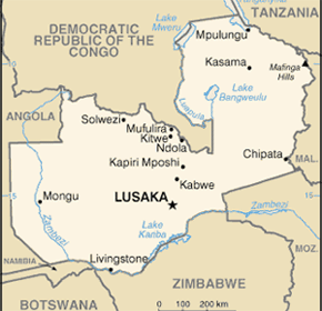 Politics
 Main articles: Provinces of Zambia and Districts of Zambia Administrative divisions The official language is
English, used to conduct official business and is the medium of instruction in schools. Commonly-spoken indigenous languages include the 7 major languages:
Chibemba,
Chinyanja,
Lunda,
Chitonga,
Kaonde,
Silozi and
Luvale. These 7 languages are taught in schools and broadcast on national radio and television. The
Ethnologue report on Zambia
lists 42 languages and many more dialects spoken in Zambia. A Zambian languages website
lists 78 languages. Some of the difference may be attributed to dialects in the Ethnologue list being counted as languages in the second list.
A number of the indigenous languages have altered quite dramatically during the process of urbanisation, Zambia being one of the most urbanised countries in Africa. Languages have assimilated words from other indigenous languages and English to such an extent that urban dwellers will often differentiate between the urban and rural dialects of the same language by prefixing the rural languages with 'deep'. E.g. a Bemba speaker might say "I don't know that word it is deep Bemba."
Languages Main articles: Education in Zambia and List of schools in Zambia Education Schooling usually falls into three levels: Primary (years 1 to 7), Junior Secondary (years 8 to 9) and Upper Secondary (years 10 to 12). So-called "basic schools" teach years 1 to 9, as year 9 is considered to be a decent level of schooling for the majority of children; however, schooling is only free up to year 7, and
Unesco estimated that 80% of children of primary school age in 2002 were enrolled. Most children drop out after year 7 when fees are payable.
Both government and private schools exist in Zambia. The private school system began largely as a result of Christian mission efforts during the late 19th and early 20th centuries. Amongst famous private schools are the Roman Catholic run St Mary's Seminary located in the Msupadzi area, south of Chipata, Eastern Province and Simba International School close to Ndola, Copperbelt Province. Private schools operate under either the British or American way of schooling, but also offer curricula approved by the Examinations Council of Zambia.
Lower education Educational opportunities beyond secondary school are limited in Zambia. After secondary school, most students study at the various colleges, around the country.
There are two main universities: University of Zambia (UNZA) and Copperbelt University (CBU). They normally select or invite the brightest students to pursue courses there and competition to get in is very tight. The introduction of fees in the late 1990s has made the pursuing of an university level eductaion quite hard for some, although bursaries do exist from the state. In the late 1970s Copperbelt University (CBU) opened on the copperbelt, taking over most of what previously was the Zambia Institute of Technology (ZIT) site in Kitwe.
Other places of learning include NIPA (Public Administrations College), NORTEC (Northern Technical College), NRDC (National Resources Development College),Evelyn Hone College, ZIBSIP, ZCAS, ZAMIM etc.
Several teacher training colleges offer two-year programmes beyond high school, missionary hospitals dotted around the country offer high quality training of an internationally acceptable standard to nurses and several Christian schools offer seminary-level training.
University of Zambia Copperbelt University Higher education Main article: Geography of Zambia Geography In the Zambezi River basin, there are four major rivers that either run through Zambia or form the country's borders: the
Kafue, the
Luangwa, the
Kwando and the
Zambezi. The last three form part of Zambia's southern borders. The Kwando River forms Zambia's south-western border with
Angola, then it runs easterly along the northern boundary of Namibia's
Caprivi Strip before spreading into the
Linyanti Marshes, which finally drain eastwardly into the Zambezi. From its confluence with the Kwando, the Zambezi flows east, forming the whole of Zambia's border with
Zimbabwe.
The other two rivers, the Kafue and the Luangwa, lie entirely within Zambia and are major tributaries of the Zambezi. Their confluences with the Zambezi are on Zambia's Zimbabwean border at Chirundu and
Luangwa town respectively. Before its confluence, the Luangwa River forms part of Zambia's border with
Mozambique. From Luangwa town, the Zambezi leaves Zambia and flows into Mozambique, and eventually into the Indian Ocean's
Mozambique Channel.
The Zambezi falls 100
m (360
feet) over the 1.6 km (1
mile) wide
Victoria Falls, located in the south-western corner of the country, subsequently flowing into
Lake Kariba.
The
Zambezi Valley, running along the southern border, is both deep and wide. Moving northwards the terrain shifts into a high plateau of 900 to 1,200 m (3000 to 4000 ft) to over 1,800 m (6000 ft) in the northern area of the Copperbelt. In the east, the
Luangwa Valley curves southwards with hills on either side until it enters the Zambezi. In the west, large plains are a key geographic feature, flooding the western plains during the annual rainy season (typically October to April).
Zambezi River basin Zambia hosts two major rivers from the Congo River basin: the
Chambeshi and the
Luapula. The latter forms part of Zambia's border with the
Democratic Republic of Congo. The Chambeshi lies entirely within Zambia and is the furthest headstream of the Congo River. It flows into the
Bangweulu Swamps, which provide the waters that form the Luapula River. The Luapula flows south then west before it turns north until it enters
Lake Mweru. The lake's other major tributary is the
Kalungwishi River, which flows into it from the east. The
Luvua River drains Lake Mweru, flowing out of the northern end.
Lake Tanganyika is the other major
hydrographic feature that belongs to the Congo River basin. Its south-eastern end receives water from the
Kalambo River, which forms part of Zambia's border with Tanzania. This river has Africa's second highest uninterrupted waterfall, the
Kalambo Falls. (The continent's highest waterfalls is the
Tugela Falls in South Africa.)
Congo River basin Main article: Economy of Zambia Economy Main article: Demographics of Zambia Demographics and ethnicity See also: History of Church activities in Zambia Religion Zambia's constitution identifies the country as a
Christian nation, but a variety of religious traditions exist. Traditional religious thought blends easily with Christian beliefs in many of the country's syncretic churches.
Islam also has a visible presence especially in urban settings.
Within the Christian community, a variety of denominations can be found:
Roman Catholic,
Anglican,
Pentecostal,
New Apostolic Church,
Lutheran,
Seventh-day Adventist,
Jehovah's Witness and a variety of
Evangelical denominations. These grew, adjusted and prospered from the original missionary settlements (
Portuguese and Catholicism in the east from
Mozambique) and Anglican (English and Scottish influences) from the south. Except for some technical positions (e.g. physicians), western missionary roles have been assumed by native believers. After
Frederick Chiluba (a Pentecostal Christian) became President in 1991, Pentecostal congregations sprouted around the country. Further information on the growth of Christianity can be found at the
History of Church activities in Zambia Zambian-born
Archbishop Emmanuel Milingo was a high-ranking Bishop at the
Vatican until he left to marry
Maria Sung, a 43-year-old Korean acupuncturist, at a ceremony officiated by the Rev.
Sun Myung Moon in New York (May, 2001). He was ex-communicated by the Roman Catholic Church in September, 2006 for conducting a
consecration of 4 married men as bishops.
Christianity Islam in Zambia constitutes about 5% of the population. run by the Baha'i community is particularly active in areas such as literacy and primary health care.
Art and Culture List of Zambia-related topics List of Zambians List of national parks of Zambia History of Zambia Monuments and Historic Sites of Zambia Communications in Zambia History of Church activities in Zambia Transport in Zambia Foreign relations of Zambia Military of Zambia Zambia Scouts Association Zambia Medical Mission Project Zambia

No comments:
Post a Comment